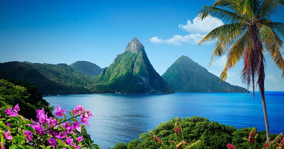
Sainte-Lucie : Une île hors du commun
The final 4K footage of my drone flights in Saint Lucia (Caribbean) with my DJI Phantom 4; project finished and uploaded on 2018-01-08 - enjoy! :-)
Media data: This drone video (3:54min playtime) is an extraction of my 41.3GB Saint Lucia 4K Drone Video Footage. Footage on Sale. For inquiries, contact me via E-Mail or my Facebook Page.
Saint Lucia Drone Flight: Saint Lucia is a sovereign island country in the eastern Caribbean Sea on the boundary with the Atlantic Ocean. Part of the Lesser Antilles, it is located north/northeast of the island of Saint Vincent, northwest of Barbados and south of Martinique. It covers a land area of 617 km2 (238.23 sq mi) and reported a population of 165,595 in the 2010 census. Its capital is Castries. [wikipedia]
Among others, you will see following places in Saint Lucia by Drone: Castries, Soufriere, Pigeon Island, Gros Islet, Rodney Bay, Vieux Fort, Dennery Quarter, Canaries, Choc, Babonneau, Charlotte, Pointe Sable, Palmiste, Corinth, Ciceron, Sapphire, Marigot Bay, Vigie Beach, Mome Fortune, Derek Walcott Square, Bideau Park, Eniskillen Monument
Video taken with the DJI Phantom 4 Drone in March 2017
#####
One Man Wolf Pack - www.onemanwolfpack.de
Facebook: www.facebook.com/onemanwolfpackFIT
Instagram: www.instagram.com/onemanwolfpackdrone
#####
Music: Axol - Mars [NCS Release]
https://soundcloud.com/nocopyrightsounds/axol-mars-ncs-release
Copyright © One Man Wolf Pack 2018 - www.onemanwolfpack.de
"
Source photo d'illustration : stlucia.org